Features ALLMA - skogbruksplan på nett
The ALLMA app is a map application that gives the forest owner a digital forestry plan.The version contains many useful features for forestry.
You can turn on the GPS to find out where you are in the terrain.
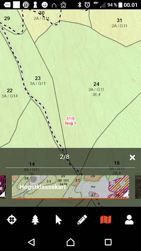
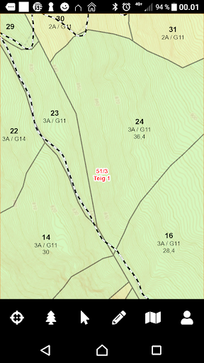
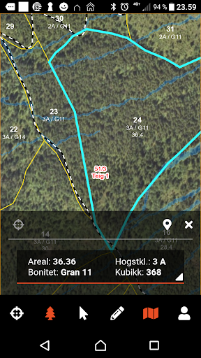
You can click on stock to see details such as crop class, quality, volume and measures.
All other objects can be identified with the identifier tool.
You then get all the information about eg key biotopes, cultural monuments, species maps etc.
There is a measuring tool to measure length and area.There are several types of maps to choose from.The app is optimized for your forest, but will also work for the contractor and forestry manager.The solution was developed by AT Skog, Allskog and Glommen Mjøsen Skog.
Order ALLMA subscriptions and access your forestry plan data at www.allma.no
Fitness Tracking
Track your workouts and monitor your health metrics.
Financial Tools
Manage your finances and track your expenses easily.
Travel Features
Plan and manage your travels with ease.
See the ALLMA - skogbruksplan på nett in Action
Get the App Today
Available for Android 8.0 and above